Gran Canaria by motorcycle: A day beyond the beach
Most of us have visited the Canary Islands once or twice, enjoying near-summer weather when winter is at its bleakest back home in the Nordics. But if you’re anything like me, the beach or pool starts to lose its appeal after a couple of days. Perhaps you’ve rented a car on the island and found yourself thinking those winding roads would be far better experienced on two wheels?
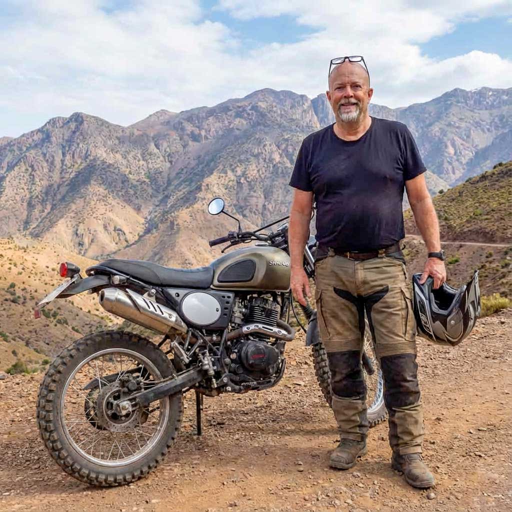
Here, Micke Westin – who has spent many years riding on the island – shares his tips for those looking to rent a motorcycle for a day, starting from the south coast where most of the hotels are located.
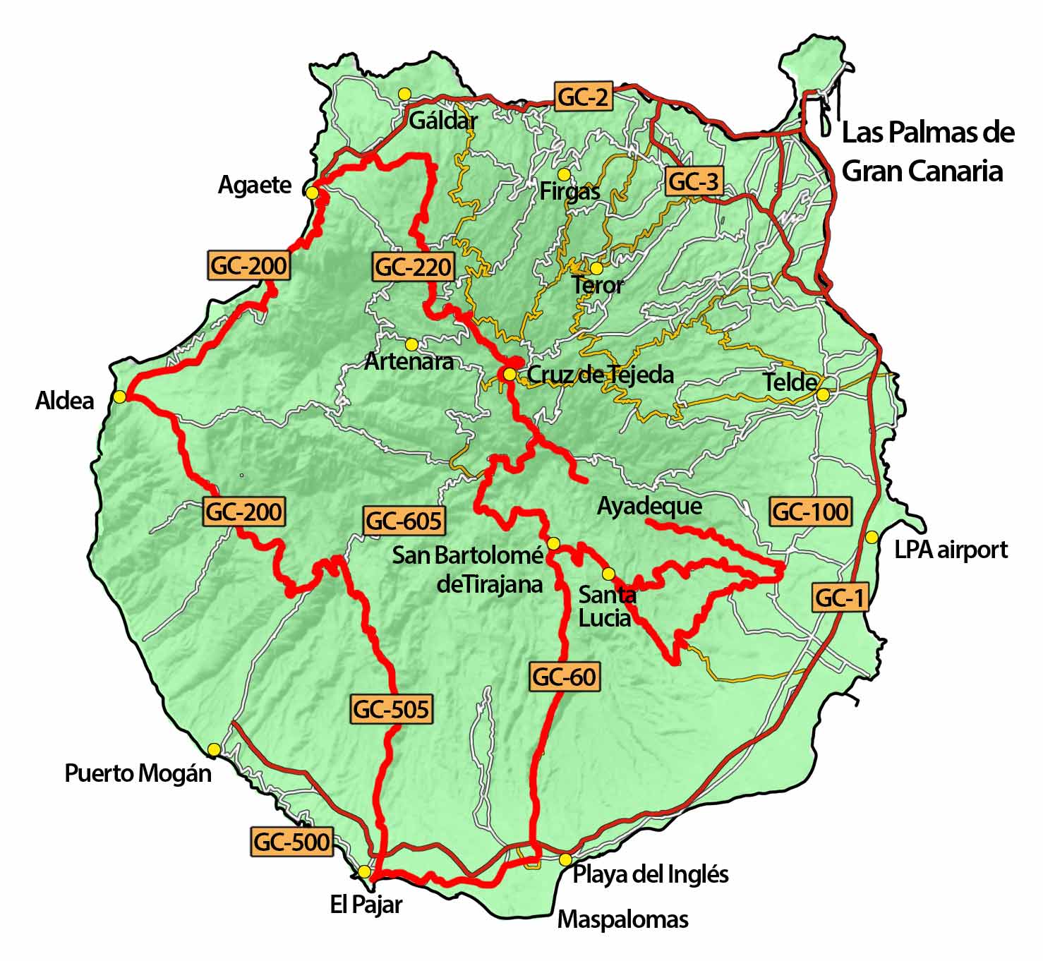
This is a long day ride of around 300 kilometres, along roads packed with countless tight bends that demand both physical and mental focus. You’ll almost certainly sleep well that evening after returning your rental bike.
Up from the coast
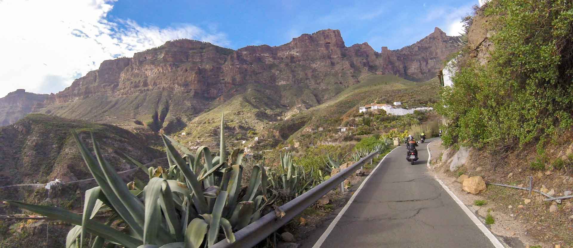
Start by taking the GC60 towards San Bartolomé de Tirajana. It’s a beautiful road with few junctions, reducing the risk of cars pulling out in front of you. However, there are many rental cars driven by inexperienced drivers, so extra vigilance is essential. Local drivers tend to be cautious, which helps keep the pace relatively calm. Halfway up the GC60 lies the charming village of Fataga, well worth a stop for a wander through its narrow streets.
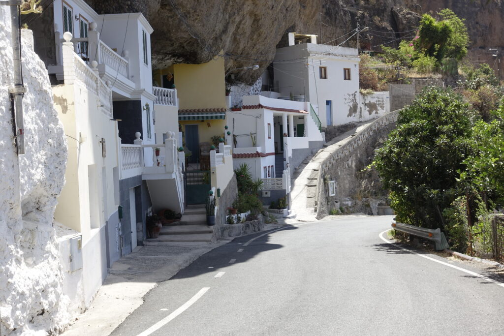
Just before reaching San Bartolomé de Tirajana, turn onto the GC65 towards Santa Lucía. Visit the church and snap a photo by a statue that, in a curious way, feels distinctly “Swedish”. Continue down to the GC551 and onwards to the historic town of Agüimes. Drive almost through the entire town before turning up a small lane marked GC103 and Guayadeque.
Guayadeque is a fascinating cave village carved into the mountainside within a long valley. Take a stroll along the small footpath around the ridge and grab some water or a cola at one of the cave restaurants. It’s warmer than you might expect, so stay well hydrated. Then retrace your route back to Agüimes. The road, the curves and the smooth tarmac may tempt you to pick up the pace, but where it’s signposted at 40 km/h, respect the limit. Children often play near the roadside by the restaurants.
Towards the summit
Take the GC103 back to the GC100 and rejoin the GC551, then soon turn left onto the GC550, which leads back to Santa Lucía. For lunch, Restaurante Mirador at the northern end of the village offers great food, views and convenient parking.
Continue uphill on the GC65 back to San Bartolomé de Tirajana and pass through the town on the GC60 all the way to the small mountain village of Ayacata, where you’ll find a few good cafés. Turn right onto the steep GC600 towards Roque de Nublo – the “Cloud Rock” – which offers a rewarding hike of about an hour, provided it’s not too hot.
From there, turn right onto the GC130 towards the island’s highest peak, Pico de las Nieves (“Snow Peak”), where the road takes you almost all the way to the top – only the final ten metres require a short climb. The true highest point, Morro de la Agujereada (1,965 metres above sea level), lies just 50 metres away but involves dangerous climbing and is not recommended.
Cruz de Tejeda
Head back a few kilometres, then turn onto the GC150 towards Cruz de Tejeda, a popular meeting point where local riders gather for coffee at weekends. There are many excellent roads here, but for this route, continue behind the hotel along the GC150. With freshly laid tarmac, it’s a dream to ride – high up and often above the clouds.
Where the GC150 meets the GC21, the final stretch is a one-way road that ends in a dangerous bend, so take great care. There’s also a viewpoint here overlooking the volcanic crater of Pinos de Gáldar – a perfect place to catch your breath, have a snack and drink more water.
Turn left onto the GC21 for a few hundred metres, then right down onto the GC220. This winding road takes you all the way (about 23 kilometres) down to the motorway near Gáldar. There’s a large HyperDino supermarket where you can grab freshly squeezed orange juice and some carbohydrates if you need a boost.
Take the left exit at the roundabout just before the motorway bridge onto the GC293. This road avoids the motorway and leads you the back way down to Puerto de las Nieves/Agaete. There are a couple of good petrol stations just before the village. Take a coffee break here if you didn’t already stop in Gáldar – you’ll need the energy. If you have time, consider riding into the valley towards El Sao to visit a coffee plantation, but allow an extra hour.
The road above the sea
Navigate your way through Agaete. You can turn down a lane by the church, cross an old bridge, and emerge onto the GC172. A couple of hundred metres later, turn left onto one of Europe’s finest roads: the GC200. Finding your way through the village can be tricky, but it’s small, so a few extra laps won’t hurt.
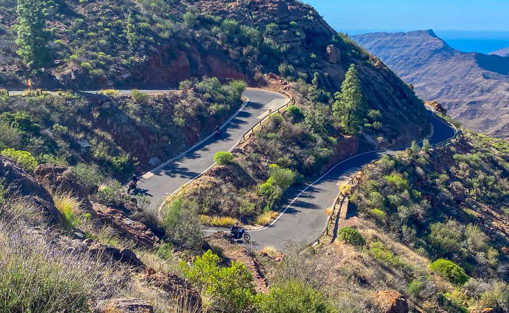
The GC200 is very popular with local riders at weekends. Unfortunately, it’s both dangerous and expensive to maintain, and parts are being replaced by tunnels through the mountains. Some sections are already closed, and as a through route, it’s gradually disappearing. A real shame, as it’s an extraordinary road despite its risks. I often ride this stretch back and forth simply for the joy of it, usually turning around at the cafés in El Risco, since the coastal section between Agaete and El Risco is the most spectacular.
Then take the newly built motorway through the three-kilometre tunnel towards La Aldea. Down by the pebble beach, you’ll find a couple of excellent fish restaurants if you’re still hungry.
Back into the Mountains
The village of La Aldea stretches out for miles and has a Spar shop if you need more water. Watch for the sign towards GC200/Mogán – the right turn is easy to miss. If you do miss it and continue straight, you’ll end up on the GC210, another favourite, but extremely narrow and winding, and it leads back towards the highest peaks – too much for this already full day.
For this route, turn onto the continuation of the GC200. It crosses the mountains and remains winding, though without the dramatic coastal views. A few kilometres before Mogán, you’ll pass a closed restaurant and a sign pointing left up the GC605. This road offers 33 glorious bends through pine forest, but the upper section has poor tarmac. Instead, turn right onto the private road GC505. It’s also in rough condition, but compensates with sharp bends, a terrifyingly narrow width without guardrails, and an unforgettable experience – even at 30–40 km/h.
This road leads down to the fish restaurant in El Pajar (Arguineguín), which is always packed. The waiters are all from the local football team, and it’s a great spot for an early dinner. Finally, take the GC500 back towards Playa del Inglés.
This route takes a full day and includes several thousand bends. By the time you return, you’ll be thoroughly worn out – in the very best way.
Facts about Gran Canaria
Location & size
Landscape
Weather – year round
For motorcycle riding
Quick facts about the route
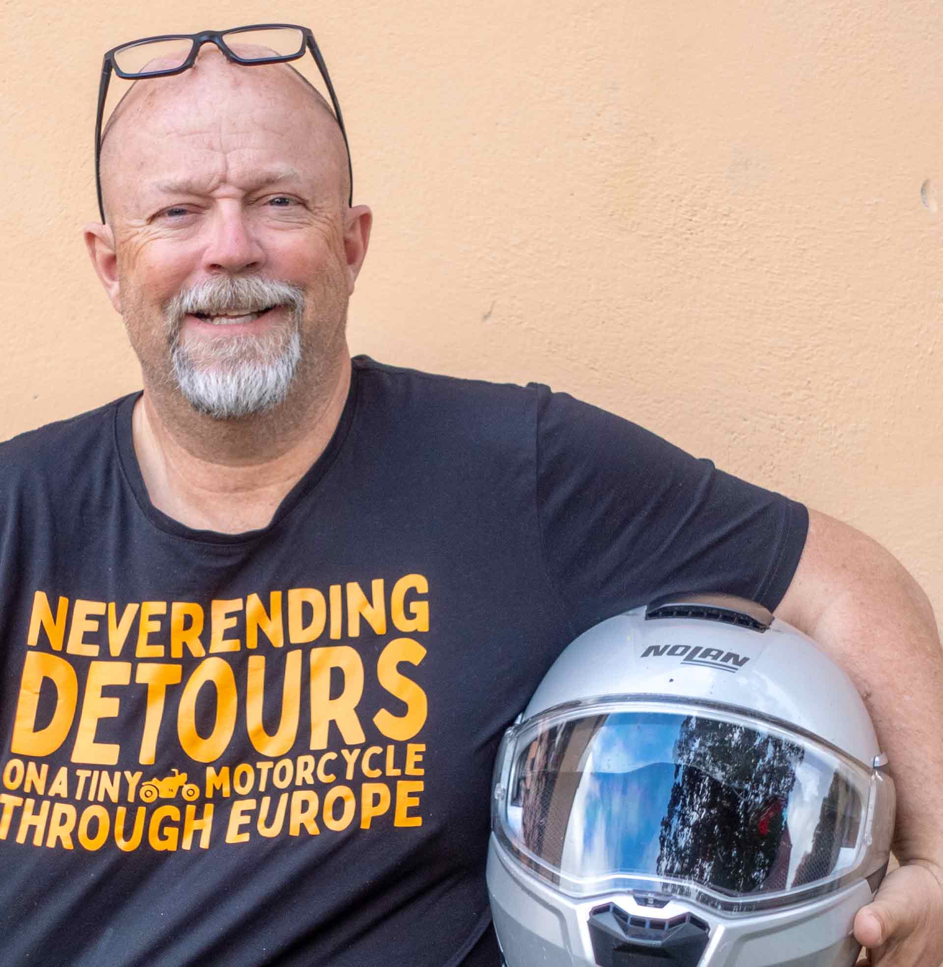
Micke Westin